WE HAVE BIG PLANS TO MAKE BACKYARD TRAILS EVEN BETTER.
BYT is Charlotte’s definitive example of primitive, technical, urban trail, weaving its way through the remnants of a 100 year old water treatment plant and using the remaining earthworks and manmade structures to create a unique riding experience. BYT is a down and dirty trail system, built to be rugged, challenging, and creative. Consisting of several segments, all trail can be linked together via the Little Sugar Creek Greenway, including the nearby Park Road Park trails.
Front Third: AKA “Farmbrook Loop” or “Skinnies Loop,” the Front Third is BYT’s least challenging area (not easy, just easier). The trailhead is located on Farmbrook Dr, east of Tyvola Rd. Go left upon entering the Farmbrook Trailhead and be treated to a self-contained loop which returns to the trailhead.
Middle Third: Middle Third encompasses the majority of the BYT trail system, and can be access from a Little Sugar Creek Greenway, or by going right at the Farmbrook trailhead. This portion of trail includes many notable areas such as the Poo Tracks (narrow concrete railways from an early 1900’s water treatment plant), miles of awesome primitive singletrack, and multiple session-able jump lines.
Back Third: AKA “Tech Loop,” BYT’s most technically challenging section. This trail segment can be accessed via a trailhead along Little Sugar Creek Greenway, and features several miles of intentionally challenging terrain, littered with lots of natural rock, and full of punchy climbs and technical maneuvers.
Marion Diehl: On the opposite side of Tyvola Rd from the bulk of BYT, located in the wooded areas surrounding the Marion Diehl Recreation Center and the Queens College Athletic Fields. This trail segment can be accessed via Little Sugar Creek Greenway. Use the greenway to pass underneath Tyvola Rd, then follow the trail which parallels Tyvola Rd for a short distance until the loop begins. MD has several miles of trail with ample elevation change, which translates into lots of climbing. By far the most primitive, and steepest terrain available at BYT.
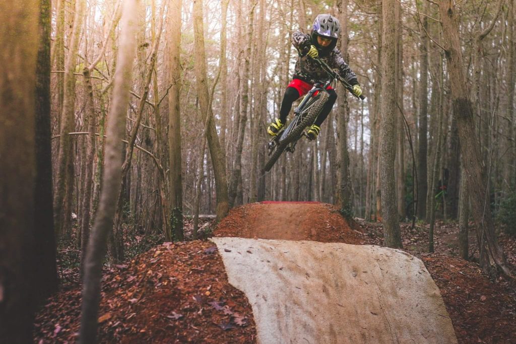
Jump Lines: BYT has three notable jump line areas, all of which are separate, session-able loops accessible via the main trail throughout Middle Third.
Original Jump Line Area: AKA “Old Jump Line” this segment houses multiple lines feeding into a single return climb. This area has a vast array of terrain, most of which is rollable, however some lines have mandatory gaps. Tabletops in this area vary in size from 12ft to 24ft. Gaps range from 12ft to 22ft. This area is home to some natural rock features, as well as several notable jumps such as “Creek Gap” and “Pipe Dream.” This area has terrain suitable for beginners, but also houses the largest and most daring features on the property. Look before you leap, and make sure you know what lies ahead.
Mini Loop: A series of rollers, berms, and jumps built into the rolling topography of former water treatment plant earthworks. Along the loop there are three main jumps: a tabletop and two low-consequence gap jumps, approx 15 ft each. These jumps are for fairly experienced riders, but have a little forgiveness built in for those who are learning. 100% rollable bypasses to all features.
Dirt Jumps: Contains two BMX-style rhythm sections, one rollable tabletop line, and the other entirely mandatory gaps. Jumps in both lines are spaced in quick succession throughout the line so the rider can pump from one jump to the next, building speed and momentum without having to pedal. Lips and landers are steeper, requiring more body english, pumping, and nosing than other jumps at BYT. The tabletop line is suitable for beginners, the gap line is for more experienced dirt jumpers.


